talahú.design
Mi Teleférico (La Paz—El Alto Cable Car)
Transit Map,
Present
•July 2025
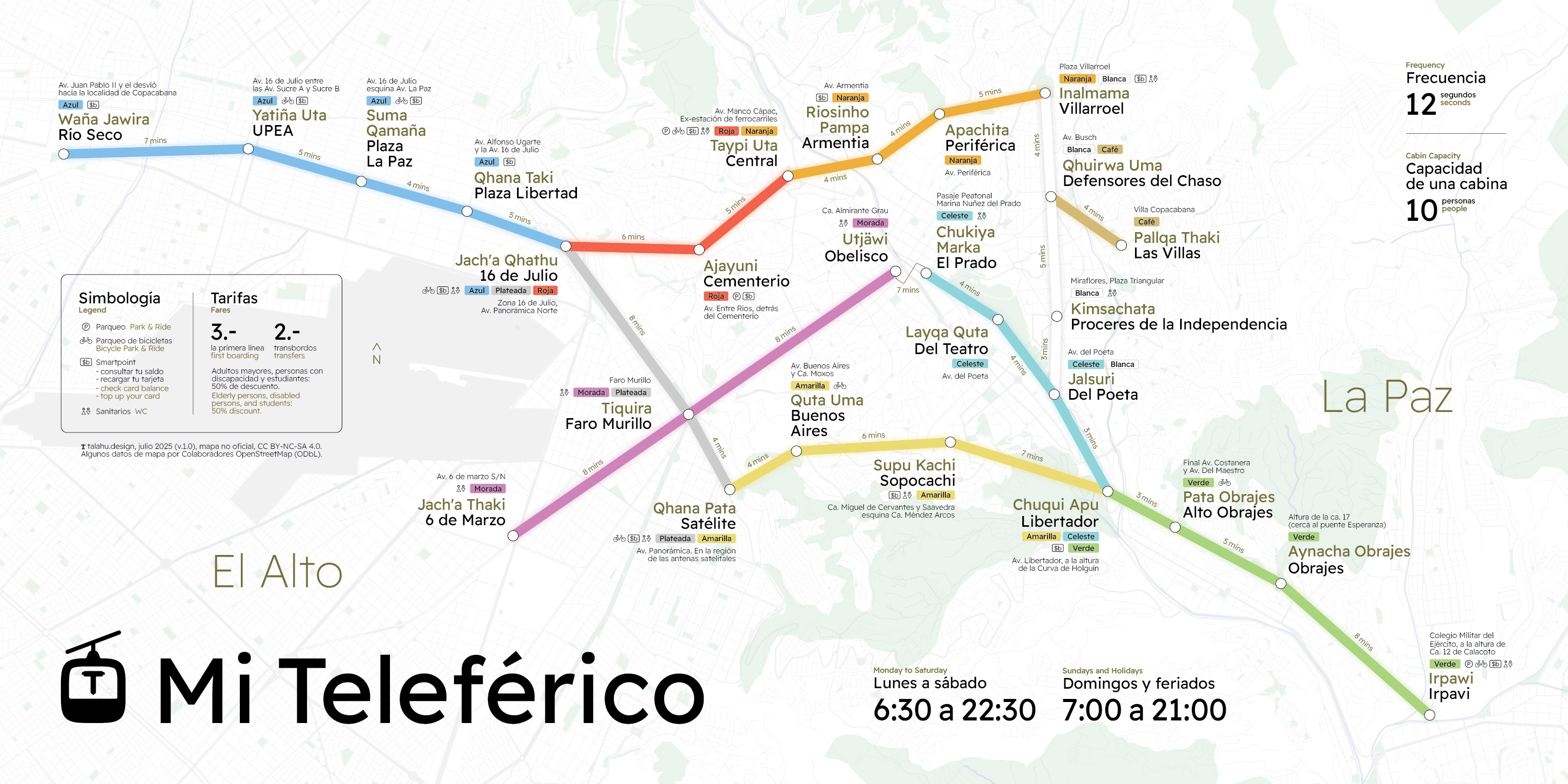
This is a map of the La Paz—El Alto cable car, an urban transit system in Bolivia's capital area. The cable car isn't a typical train- or bus-based system, so I find it necessary to reflect the key differences in the design.
Specifically:
- With an average of 3.2 stations per line, it's probably better to list lines next to each station than to list them once in the legend.
- And 26 stations isn't a lot, so each one can show more information, like services available at the station and location details.
- Stations are spread out unevenly, and travel time between two neighboring stations can be up to 8 minutes, so showing travel times might be a good idea.
- While the headway is extremely short (allegedly just 12 seconds!), each cabin only fits 10 people. I've read about (former?) limitations related to luggage but couldn't find any official rules.
Workflow for OSM data: overpass turbo → QGIS → Adobe Illustrator